A common land year, September

Flordon Common

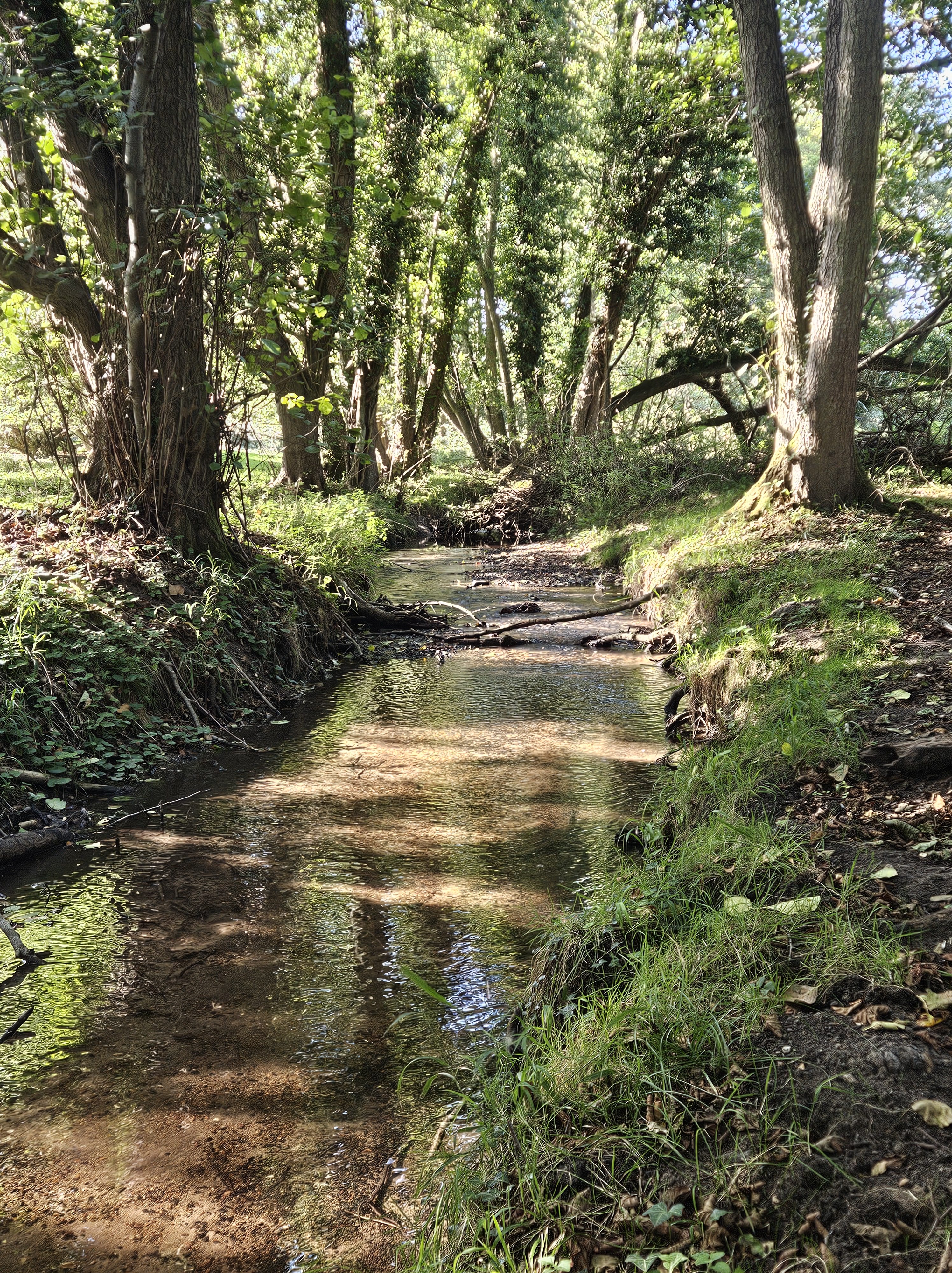
Rachael asked me ‘how did it survive?’. We were sat on a fallen tree beside a beck that moved swiftly over stones. Running water is not a noise I hear often in Norfolk, a county of low hills and quietly moving rivers. It is a sound I seek out when I can. Between Rachael and I were our flasks of tea and the biscuits I had bought on the way. Both of us were dressed in boots and work trousers, our untidy hair tidied loosely back, although Rachael’s is a shade lighter than mine, more strawberry blonde than my red-brown. As well as the biscuits, we also shared the ease of a long-established friendship.

Around us Flordon Common was so tangled it felt like a place that had rarely changed in a thousand or more years. The marshy ground had been lightly grazed by a herd of cattle that now slept beneath trees across the beck, sedges and reeds grew in tussocks. Willows and alders cast dappled shade around us and I knew that if I touched the water, it would be cold, despite the warmth of the afternoon. Like many Norfolk streams, this one is born from the deep bedrock of chalk beneath East Anglia and rises clear and icy, even in on a sunny autumn day.

I knew too what Rachael meant by her question. How did this land survive the enclosures of commons, the ploughs and the agricultural sprays, and the endless tidying up and homogenising of the Norfolk countryside? The ripping up of hedges and copses, the filling in of ponds and straightening of rivers into deep, unnatural drains. How did it manage to escape, so that the willows and alders grow tangled and wild, so that the summer orchids flower and the meandering stream are still here?

Art critic Lucy Lippard writes that all places are stories waiting to be unearthed. Flordon Common will have its story – a hunt through archives and old maps would reveal some of it, although much might not be written down. Sat on the fallen tree, I answered Rachael with a guess that this was once a part of a large village common, where cattle were grazed and firewood gathered. On our visit, and despite a summer of drought, the land was damp after recent rain; likely then it would once have been too hard to drain or to plough – the returns not worth the investment. Both of Racheal and I had parents who grew up in a Norfolk where horses were still used on the land; it feels so long ago, a time when effort and labour were measured differently from now. Being difficult gave this land a chance of survival.

Perhaps, too, it was left as common during the great waves of enclosure that swept Norfolk, and indeed the rest of Britain, from Tudor times until the early nineteenth century. Locals may have put up a fight to retain it. Too poor to employ lawyers, they may have refused to leave their mark on legal papers, damaged fences or whispered sedition in the pub. More likely, it was left as a place where a few villagers could carry on collecting wood and grazing stock – a crumb of land thrown to the poor as compensation for the common fields that were being fenced in for crops or for sheep. Helping those dispossessed by the loss of their commons was not only a matter of humanity or Christian charity. Many enclosures took place in the decades after the French Revolution and the land owners of Britain saw helping the poor as a way, quite literally, of keeping their heads. ‘Poors’ land, also known as ‘doles’ or ‘charity lands’ can be found across Norfolk still; some were leased out for money that was distributed to the poor of the parish, whilst others had rights for firewood or grazing granted to local households. Even now, some poors lands are overseen by local committees ruled by the local squire and the church.

When Rachael and I got up to leave, I scattered a few biscuit crumbs on the ground. It is an old habit from my youth, from the days when I lived out on the land, squatting among woods and hills threatened by road building. A little thank you to a place, an acknowledgement of its lives, both present and past. As we followed the stream back to the road I recalled, to myself, the words that George Eliot wrote at the end of Middlemarch, ‘the growing good of the world is partly dependent on unhistoric acts; and that things are not so ill with you and me as they might have been, is half owing to the number who lived faithfully a hidden life, and rest in unvisited tombs’. I said to Rachael that whatever actions people have taken to ensure Flordon Common could survive, I wanted them to know I was grateful.
A common land year, August

Between the stones and the sky

Writing in September, I’ve almost forgotten how my mid-August journey to Moscar Moor scared me. All through the heatwave of May and June and July, the clay soils of my home ground held on to a few drops moisture, helping the oak trees behind my house to keep their dark leaves despite the drought. Even after the hay was baled and removed, the common grew a weak but hopeful sheen of green. My journey took me through west Norfolk, out across the Lincolnshire Fens, over the hump of the Wold and down into the Trent Valley. The roadsides offered too little shade and too many trees were turning brown as if autumn had come early. The grass was the dry gold of sand, and I felt hounded by heat, unable to escape it. The almost lush trees and fields beside the rivers of the Peak District were a welcome relief at the end of my travels. The colours were deceptive however: wildfire warnings were posted on gateways, telling every visitor that the land was tinder-dry, vulnerable to a single spark amongst the heather and gorse.

Derbyshire is not mentioned in The Common Lands of England and Wales, written in 1963 by two of the most eminent geographers of their era – WG Hoskins and L Dudley-Stamp[1]. The book covers the character, wildlife and significant commons of every county in England and Wales; I’ve checked a few times, but Derbyshire is not there. At first, I thought that this could not be true, for the unfenced acres grazed by sheep, bracken and heather and gorse look like upland commons from Dartmoor and Bodmin to Cumbria and Wales. Stamp and Hoskins were right, however, and the Derbyshire hills are not commons any more. Instead, they are enclosed lands belonging to farms, or are rented for sheep grazing.

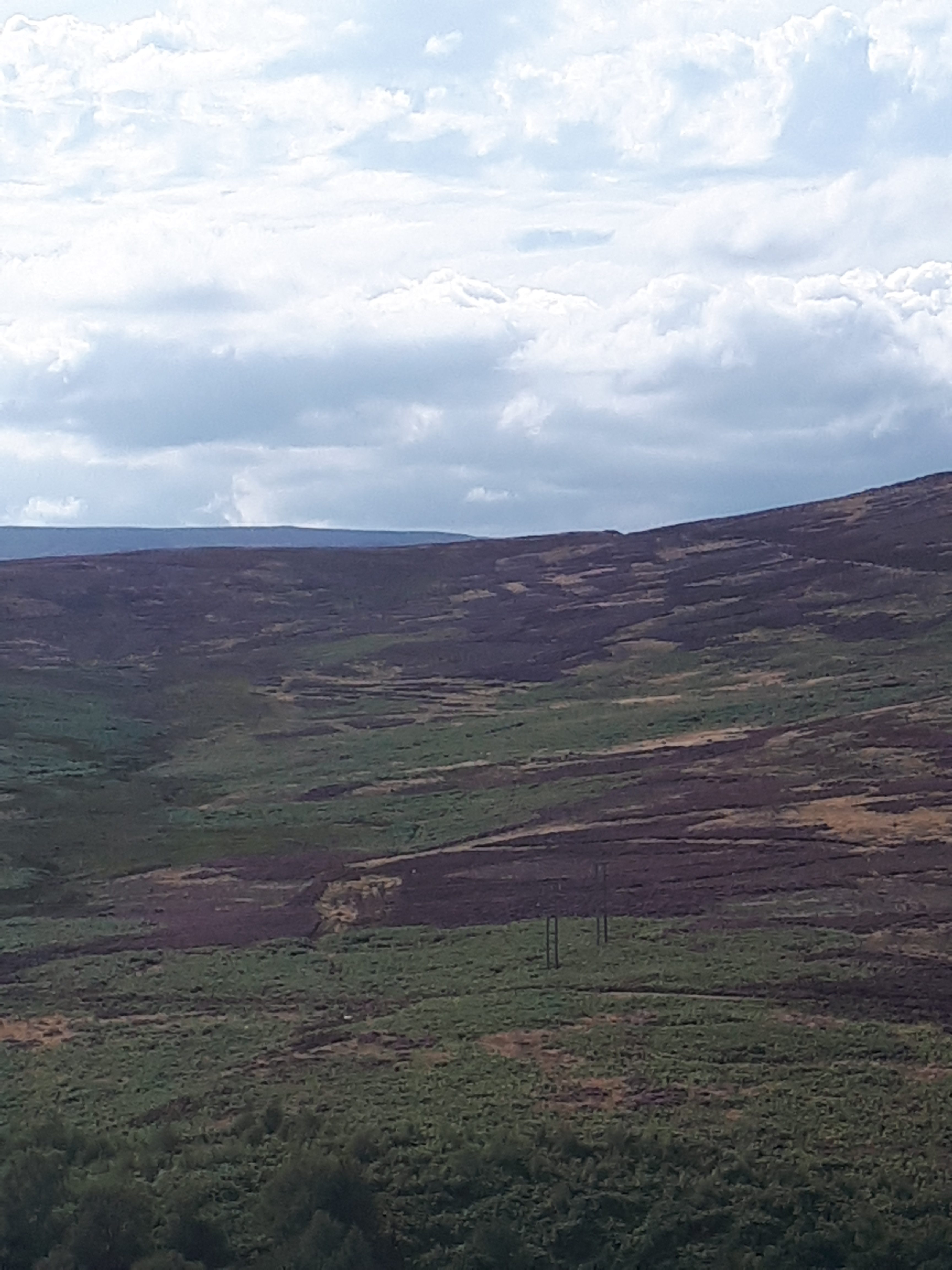
On the afternoon that I walked up Hordron Edge, the speckled grey and white face of an ewe and her lamb peeked warily from the bracken; her face was the colour of the sky. I was grateful for a day of clouds that made being outside before dusk more pleasant than it had been for weeks. This was my second walk on the ridge – the night before I’d headed up with friends to watch the Perseid meteor shower, the bright points of light and their fading tails falling amongst the shadows of hills and a wide sky of stars. Alone and in daylight now, I stood on the exposed rocks the top of the Edge, facing west and glimpsing the waters of Ladybower Reservoir between the hills. There should be a word in English for standing on a hilltop or ridge, for the sense of calm exhilaration, the impossible-to-deny urge to be still and quietly gaze at the view.

On the edge of the cliff, a single grouse scuttled into the bracken, head held high as if alarmed and a dark eye turned towards me. It was young bird, its characteristic red feathers only just emerging through the pale ones of its fledging. Watching it I recalled that this was the week of the ‘Glorious Twelfth’, the start of the grouse shooting season, and I wondered how much longer the little bird would survive. Like all red grouse it was dumpy, almost comical, and a reminder of another reason why the commons of the Derbyshire hills were enclosed. Grouse shooting has shaped this land as much as sheep grazing has, with many moors enclosed by Victorian land owners eager to bring their friends and their guns. Across Cutthroat Pass, north of my vantage point, was another legacy of grouse shooting, visible as a hillside with the green and almost black stripes and squares of heather burning. Here, over time, and on rotation, old heather had been burnt off to encourage the growth of new sprigs – the main food plant of grouse.

The patterned ground of moorland burning and grouse shoots also occurs on moorland commons across England. Over the past twenty years, I have sat on common land committees where both supporters and opponents of shooting and burning have been passionately vocal in their views. I have heard the supporters maintain that carefully controlled burns remove accumulations of dry, woody material that poses a wildfire risk. They pointed too at the income and employment that shooting brings to rural communities, and how moorland management for grouse also encourages birds like lapwings and curlews. When I first started attending meetings, the opponents spoke mainly about the shooting and poisoning of buzzards and red kites and hen harriers that will predate on grouse. Other arguments followed – how the draining of moors for shooting exacerbates wildfires, how adder populations plummet when grouse numbers are high, as the birds pick off the pencil-slim juvenile snakes, and, with increasing urgency, how some moorland management damages one of Europe’s greatest carbon sinks. When the peat is drained and then charred as the heather above it burns, it dries out and loses its ability to lock-in carbon, turning these habitats from carbon stores into carbon emitters.

The arguing has grown louder in recent years, with protests and legal challenges, highlighting opposition to moorland burning and management for grouse. There has also been legislation and new codes to limit the burns, as well as funding to re-wet the peat so that it can sequester carbon and be more resilient to wildfires. The recently burnt patches on the hill across the valley from Hordron Edge, however, were an indication that the arguments carry on – another of the many conflicts that surround Britain’s common land.

In the heat of August, after months of no rain, fire in this land was a terrifying thought. As I stood on the top of the Edge, the peat soils beneath my feet were dust-dry, as frightening as the desiccated land I had travelled through to get here. Behind me, the Bronze Age stone circle at the top of Hordron Edge was half-covered in tall heather and bracken. When I walked over to the ring of low stones, laying my hand on their lichen covered tops, I found a Brigid’s cross at its centre. It was woven from rushes, with a single feather, the grey-white of a pigeon laid across it, echoing the colours of the sky and the speckle-faced sheep. Both the cross and the feather were weighed down by a pebble. Maybe it was visiting pagans, or perhaps someone’s whim, nimble fingers weaving the green stems into an intricate shape that was once believed to bring blessings and protection. I touched the offering gently with my fingertips, whatever the intent, it brought me back to the moment and stilled the turning over of common land arguments in my mind. Sometimes it is enough to just watch the view, and to remember that people across millennia have heeded the call of high hills, acknowledging a place that stands between the stones and the sky.


[1] The Common Lands of England and Wales, Dudley Stamp, L & Hoskins, WG, New Naturalist, London 1963